
I've long been fascinated with with the interstitial spaces of cities. Back streets, alleys, shortcuts, and other little-used or liminal spaces are profoundly interesting to me. One of the reasons has to do with the arrangement of such spaces themselves. Another reason is the potential they offer for alternate wayfinding, spaces separate from the traditional grid that nonetheless allow movement through a city in ways that are often far more effective and interesting than sanctioned norms of travel.
I can pinpoint my own fascination with such spaces: I grew up in a suburban home in a suburban environment where alleys and other interstitial spaces were systematically engineered out of the landscape through rigid norms of wayfinding predicated upon the ubiquity of the automobile.
So my fascination begins in lack.
Yet while my suburban childhood was scrubbed clean of the concrete canyons, alleys, and spatial loopholes of the big city less than 30 miles away, my family's home abutted "the creek" and an industrial park across the water, and both provided some of the liminal mystery missing from suburbia.

"The creek" was in reality a series of arroyos and wastewater drainage culverts connected throughout our subdivision at right angles that paralleled our suburban streets. By age 10 or 11, my friends and I had determined who lived on "the creek" and how we might travel to each other's homes (and other places throughout the city) without ever setting foot on pavement. The flattened rock roads that bordered either side of "the creek" became our preferred mode of wayfinding--by foot or by bike--and "the creek" became our haven, a liminal and semi-private thoroughfare ignored and concsiously unseen by the good citizens of suburban car culture.
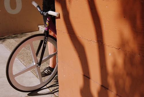
Bicycle Wayfinding
A couple weeks ago TechCrunch featured a service called Ride the City, an organization whose mission is to help cyclists navigate New York City efficiently and safely. For navigation from point A to point B, the service allows you to choose the "Direct route," the "Safer route," or the "Safe route." This is an interesting appropriation of the The OpenStreetMap, and one that is increasingly viable given the ubiquity of GPS-enabled mobile phones. Moreover, any application which serves to increase the safety of bicyclists in major urban areas is both welcome and necessary.
Today, Wyrdy published a compelling piece called The New iPhone is a Pointing Device for the Real World: The Ground Will Speak. Among the more interesting points is the discussion of augmented reality and the ability to tag and interact with real-world spaces. Both Ride The City and the News-Wyrdy piece have me thinking about the ability to increase interaction with the city, to foreground the previously unseen, and to navigate urban environments via bicycle in ways that are subversive--ways which allow non-car citizens to reclaim and repurpose the city in part by networking automotive non-places.
Yet even as I am encouraged and energized by technology-enhanced bicycle wayfinding, I have reservations that stem from rhetorics of space and map-making. I am thinking in particular about Diehl et al's fantastic article "Grassroots: Supporting the Knowledge Work of Everyday Life" and the importance of understanding and uncovering the rhetorical infrastructures of mapping and wayfinding in and through their technological manifestations.
In short, I see the tremendous potential of GPS-enabled services for increasing the ability and effectiveness of bicycle wayfinding, but I also see tremendous potential for the limiting effects of a normalized consensus about what constitutes "appropriate" or "safe" bicycle movement throughout the city. Much of cycling, in my opinion and experience, is about circumventing or subverting the norms of automobile-focused city planning. Tools such as Ride The City should allow and embrace user-generated contributions of liminal and interstitial wayfinding.

In our age, most motion is done with the assistance of technology. The farther we go the faster we go, the less our bodies have to move at all.Culley's 2001 paean to the culture of the Chicago bike messenger, though at times overwrought and over-romantic, remains one of my favorite books. Culley argues that "the problems of cycling in the American City are as real as the problems of driving in the American City. They are in fact the same problem, and the courier should be credited for overcoming the problems of transportation with such admirably simple tools."
As technology, legs themselves are almost obsolete. As technology, they have buried themselves in cars, elevators, and the telescopic hallways at the gates of airports. They are the evolutionary experiments of our species. Though we keep the hardware, we have lost the application. The intensity of our desire for motion has made our bodies merely units of transport, personal storage containers, carry-ons. ~Travis Hugh Culley, The Immortal Class
Much of Culley's book is about the philosophy that attends urban wayfinding via means anithetical to modern urban planning. He contends that
The bicycle is a revolution, an assault on civilian territory, intent upon taking, from the ground up, responsibility for the shape of our cities. It is a mutiny, challenging the ever-one-way street. The bicycle is a philosophy, a way of life, and I am using it like a hammer to change the world [....] ~Travis Hugh Culley, The Immortal ClassCulley's most lucid and effective arguments center on the experience of navigating an urban landscape built specifically to exclude bicycles. Such navigation considers the liminal, the interstitial, and those spaces consciously unseen by the automobile. More importantly, since most American cities were not built with cyclists in mind, subversive bicycle wayfinding can reveal things about the city--things which are generally ignored by mapping technologies--which can enrich our understanding of urban space.
When a motorist sees a biker run a red light, cutting through four lanes of traffic going twenty to thirty miles an hour, the driver is generally going to think that the messenger is totally insane, has no regard for anyone, and doesn't even care enough about life to look before rolling out into a stampede of steel.
[...] motorists will likely never understand this because they will never address the innate advantages a bike has over a car.
The kind of perception that drivers have behind a windshield, a set of small mirrors, a thousand-pound engine, and dashboard seriously limits their view of a cyclist's experience. The speedometer, the doors, the little sticker that says that the steering wheel is equipped with an explosive airbag, the seat belt, all of these aspects to driving a car condition the driver's mobility and perception.
Cyclists work with a much more open sense of immediate space than drivers do. They have at least 330 degrees of unobstructed vision [...] and about 720 degrees of hearing. [...] I see wholes, even at the highest speeds I can reach.
[...] Most drivers don't have this kind of metaphysical connection to their cars. The car for most people is an anesthetic, a wall between themselves and the world. ~Travis Hugh Culley The Immortal Class

How can a government of car-numbed, suburban politicians intelligently manage a street or organize a city when they are unable to see beyond their dashboards and their own symbolic aggression? Can a governing body that is so remarkably ignorant of the dynamics of a cyclist's behavior represent a cyclist's needs? And furthermore, should a governing body that only knows how to drive through a city be chosen to manage it? ~Travis Hugh Culley The Immortal ClassThese questions bring us back to the technological tools increasingly available to those who experience the city on an alternate or cross-hatched grid, who navigate the interstices unseen by the comparatively massive population of steel-ensconced citizenry.

Lines and signs marked the street lanes explicitly for automobiles. The pedestrians were sanctioned to cross inside carefully drawn white lines. I was somewhere in between, unsure of which directions to follow. ~Travis Hugh Culley, The Immortal ClassOur tools need to be used in the interests of alternate wayfinding, of uncovering and communicating--on a larger scale--the liminal spaces conducive to navigating the city via bicycle, while simulatenously claiming a greater and safer propotion of the currently cross-hatched spaces of shared navigation.
In other words, we need strategic rhetorics of mapping, wayfinding, and user-generated local communication that makes bicycles more visible and viable in our urban environments. Leveraging some of the new tools available to us--in the spirit of the Grassroots article noted above--may help us do so.

2 comments:
Thanks for the Culley excerpts. I'm trusting that I've seen the interesting bits of what he has to say(and they were interesting) courtesy of your blog, so I'll spare myself what looks to be a uncomfortable read.
I'm thinking now about how Grassroots would be useful here in SF. The SF bike map is pretty good, but doesn't tell you things like when it's better to be on the left side of a wide one way street as opposed to the right. Or where an alley can be safer and faster than well marked bike lane.
I love the small forgotten spaces too.
Thanks great blog ppost
Post a Comment